
| 南沙群岛地图 |
| |
|
|
首页
|
南沙群岛地图-古代历史地图 - 郑和航海图
所有地图请看左边地图分类。 声明:本站所收集地图上所反映的信息不一定正确。 说明:郑和航海图资料(2004-12-25日南沙群岛在线整理) -------- English Description: By the twelfth century, names for the South China Sea Islands began to appear, the Paracels and the Spratlys were referred to more consitently as Changsha and Shitang. By the mid-fourteenth century, Shitang could be accurately identified as the Spratlys. There is also evidence of Chinese naval control over some areas of the South China Sea, which resulted in complete Chinese domination of the South China Sea in the late thirteenth century. Finally, in the fifteenth century, Zheng He's seven voyages placed the South China Sea islands on the official navigational charts. In this map, the Xisha Islands are called Shitang, and the Nansha Islands are referred to as Wansheng Shitang Yu 参考书目(References):
1. Lu Ning:Flashpoint Spratlys 地图图片 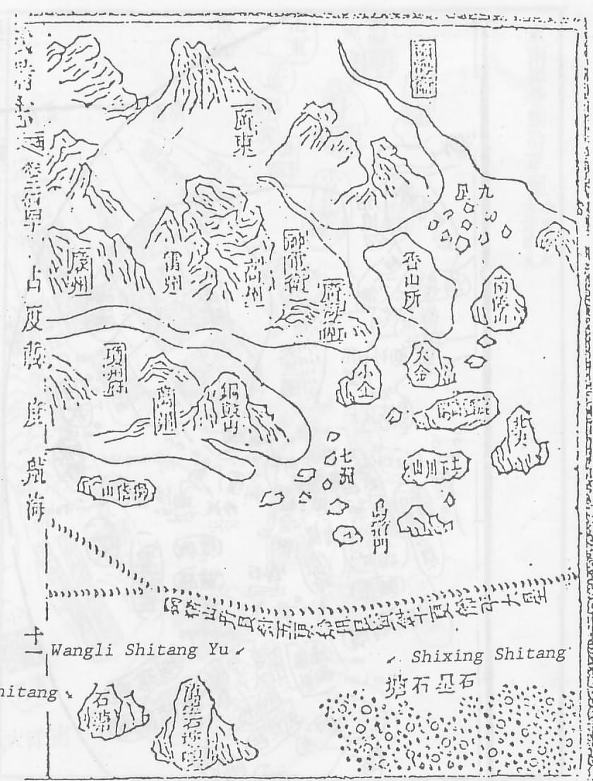
欢迎网友提供地图,联系我们写信谈感想。 |
||||
|
|