|
首页
网站目录
南沙群岛有关书籍
目录
国内出版的书籍
国外出版的书籍
书评
网上书店
书讯
|
 |
|
国外出版的书籍
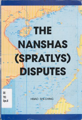
Title: Hsiao Chi-Ching The Nanshas (Spratlys) Disputes
Date Added: (2006-03-11)
Author: Hsiao Shi-Ching 萧曦清
Imprint: Color Lithographic Press, Inc., Quezon City, The Philippines
Description:
Bibliography:
Edition: First Edition 1975, Second Edition 1999
ISBN:
Note:
Subject:
Pages: 190
Image: 

目录/Table of Contents
- Forewords
Jaime L. Cardinal Sin, D.D. ...iii
Hsiao Shiching ...iv
Acknowledgement ...vii
Chapter
I. Introduction ...1
II. Geographical Position ...3
III.The Nanshas' Historical Grounds ...10
IV. The "late" Claimant Countries ...15
V. China's Defense of its Sovereignty over the Xisha and Nansha Islands ...25
VI. "Kingdom of Humanity" ...32
VII. Cloma and his "Freedomland" ...36
VIII. Mitra's Fishing Story and the Development of Nansha Disputes ...58
IX. The ROC-RP-ROV Confrontation ...73
X. PRC-RP-SRV-Malaysia Contention on Militarization Exploitation Firefight and Negotiation in the Nanshas ...82
XI. PRC-RP Mei Ji Tao Incidents ...90
XII. PRC-RP Diplomatic Row Over Huang Yan Tao ...96
XIII. PRC's Renovation of Structures in Mei Ji Tao and RP's Reactions ...102
XIV. RP's Internationalization of the Nansha Issue and Development ...110
XV. RP Navy Sinks PRC Fishing Vessels ...123
XVI. Economic Resources and Strategic Importance ...140
XVII. Controversies on RP's Claim to the "Sovereign Ownership" Over the KIG ...147
XVIII. Bases of China's Sovereignty Over the Nanshas ...153
XIX. Conclusion ...160
- List of Maps
I. Islands in South China Sea - Dongshas, Xishas, Zhongshas and Nanshas ...164
II. Topography of South China Sea in Bird's Eye View ...165
III. The Location of South China Sea Islands ...165
IV. The Distribution of All Islets of Nanshas ...167
V. On the Zhenghe's Nautical Chart of Ming Dynasty (AD 1368 - 1644), on which the Location of Xishas and Nanshas was Indicated ...168
VI. The Distance Between South China Sea Islands and the Neighboring Countries ...169
VII. The Shape of Taping (peace) Tao, the Biggest Island among Nansha Islands ...170
VIII. Claims and Occupations in the Nansha Islands ...171
IX. The Islands Occupied by the RP ...172
X. The Relative Distances from Zhong Yeh Tao (Pagasa) (From the Filipino's Point of View) ...173
XI. Map of the "Kalayaan Island Group" (Part of the Nanshas) ...174
XII. Oil Fields and Concessions in the Nansha Islands ...175
- List of Illustrations
I. The Names of the Nansha Island Group ...176
II. Estimates of Occupied Islands and Number of Troops in the Nanshas ...179
III. Naval Balance in the Nanshas ...179
IV. Air Power in the Nanshas ...180
V. Comparative Study of the Provisions of the 1987, 1973 and the 1935 Philippine Constitution ...181
VI. The Records on South Sea Islands in the Geographical Annals of Tang Dynasty (AD 618 - 907) ...182
VII. The Chinese Taking-over of the Nanshas from Japan in 1946 ...183
VIII. Freedomland North of Borneo, Freedomland includes 70,000 miles of Shallow Sea ...184
IX. Tomas Cloma (in 1970s) ...185
X. The Flag of "Freedomland" ...186
XI. Aerial View of Zhong Yeh Island which RP Boasts of an Airstrip ...187
RP Congressmen's Visit to Huang Yan Tao ...188
Completed Meiji Tao Structure in Photo Taken February 5, 1999 by a Philippine Air Force Reconnaissance Plan ...189
Cartoon I
欢迎介绍书籍和发表书评
- 如果您有什么好书介绍的话,欢迎和网友们共享。 您可以在论坛上留言,或者联系我们。
我们将发表您的评论。
|

