| 南沙群岛群岛地图 - 各声索国出版的地图
所有地图请看左边地图分类。
声明:本站所收集地图上所反映的信息不一定正确,不代表本站观点。
说明:菲律宾对我国南沙群岛和南海海域的主权要求区域(2005-06-04日南沙群岛在线整理)
地图图片1 ―― 菲律宾的领土界限
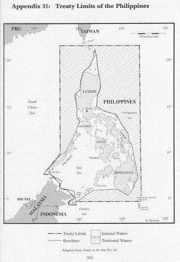
地图来源:The Contested Maritime and Territorial Boundaries of Malaysia by R. Haller-Trost
中文说明:
这是历次协定对菲律宾领土范围的规定,从此图可以清楚看出我国南沙群岛不在菲律宾领土界限之内。
English Description:
This map shows clearly that the Nansha Islands are not within the Philippine jurisdiction.
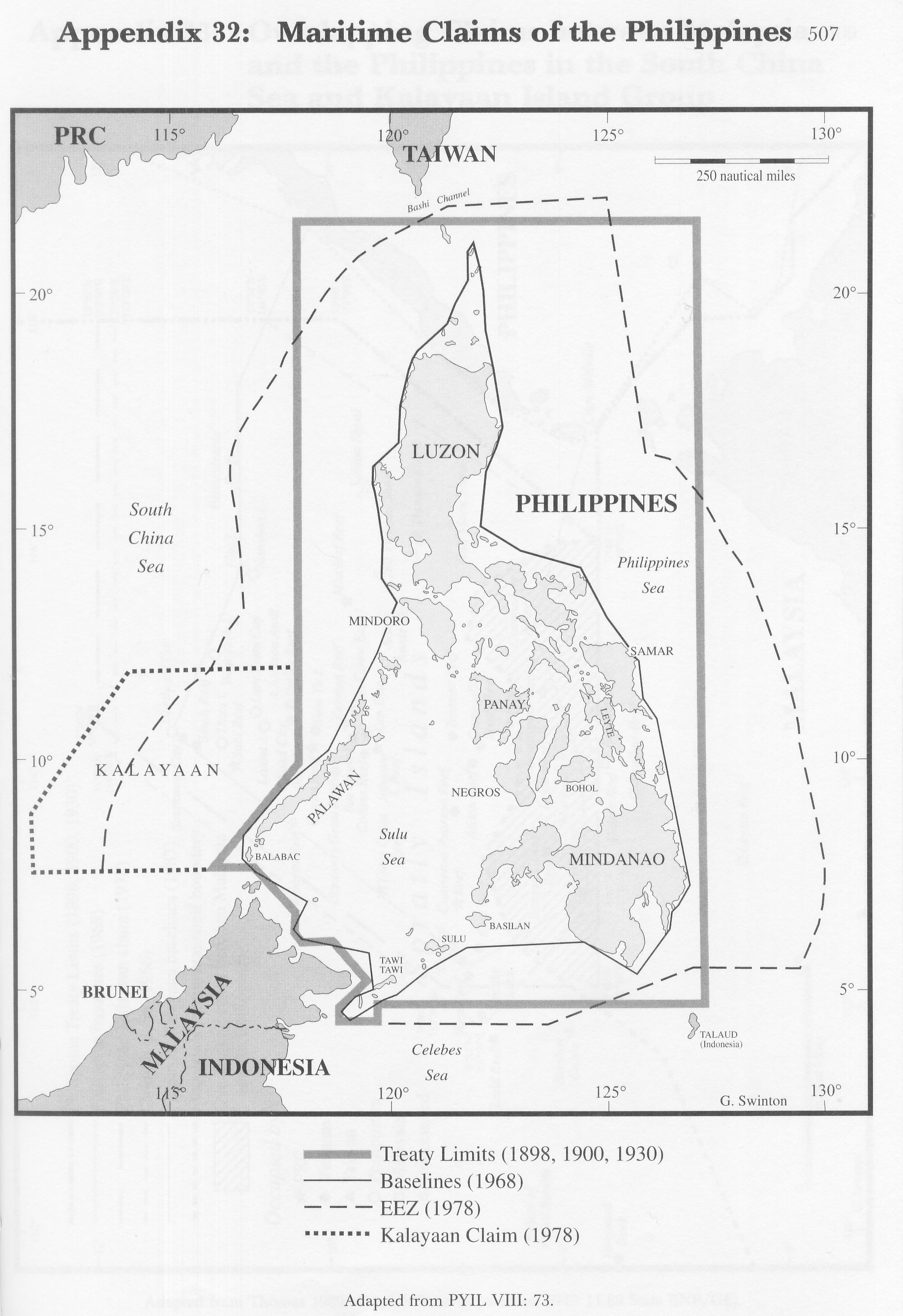
地图图片2――菲律宾领土界限和其单方面声称的专属经济区及所谓“卡拉延”声索范围
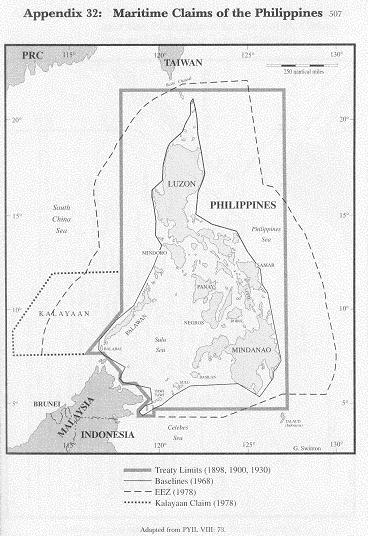
地图来源:The Contested Maritime and Territorial Boundaries of Malaysia by R. Haller-Trost
中文说明:
这幅地图显示菲律宾单方宣布的专属经济区和其对所谓“卡拉延”群岛的范围界定。
English Description:
This map shows the unilateral claim of EEZ by the Phillines and its illegal claims of part of China's Nansha Islands
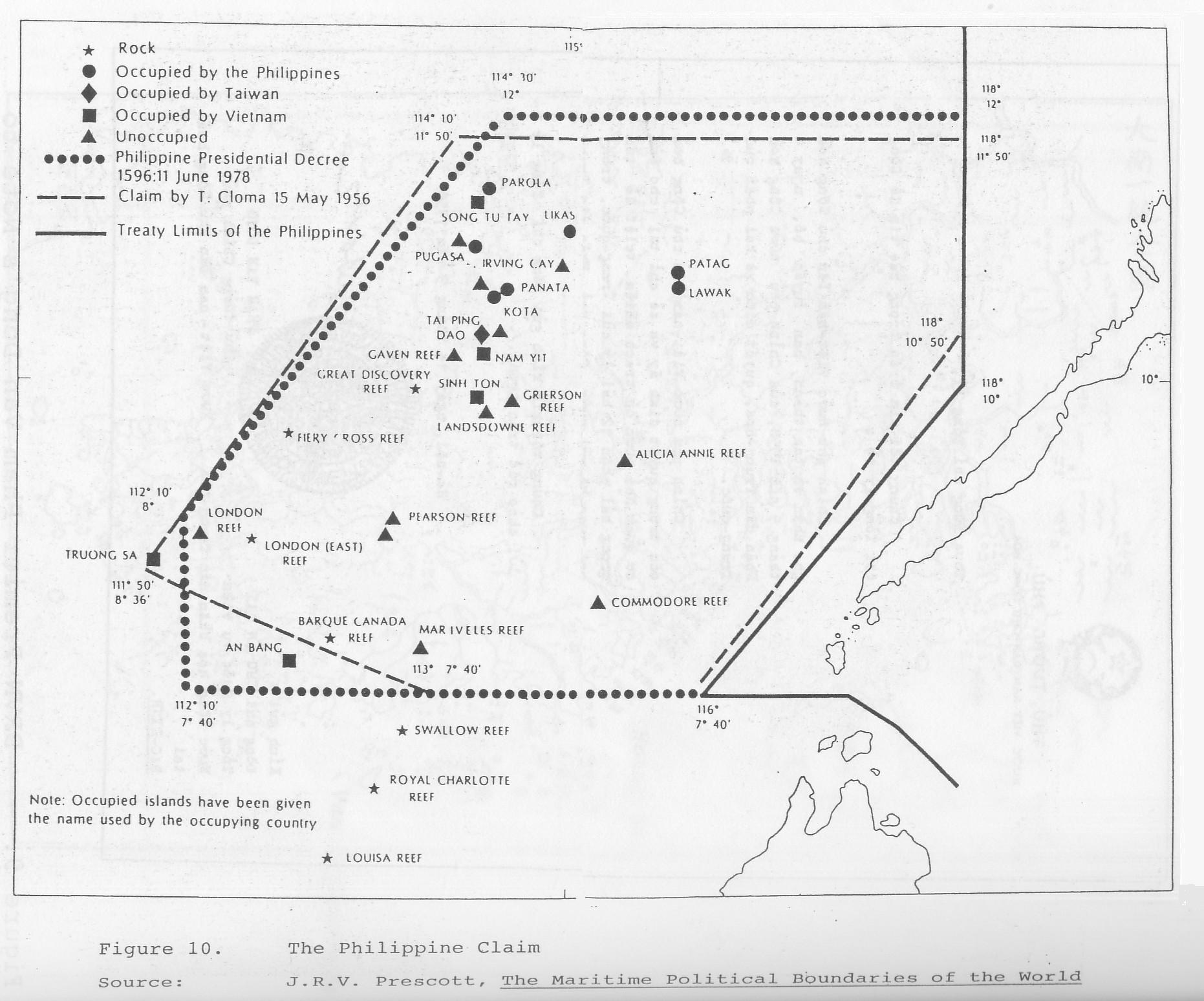
地图图片3 ―― 1956年克罗马和1978年菲律宾总统法令1596号对我国南沙群岛和南海海域的主权要求区域

地图来源:Lu Ning: Flashpoint Spratlys
中文说明:
这幅地图显示的是1956年克罗马和1978年菲律宾总统令1599号中对于所谓“卡拉延”群岛范围的界定。
English Description:
This map shows the area Tomas Cloma claimed to "discovered" in 1956, (China has included the area into her official maps
since 1935 but yet this crazy Cloma claimed that he "discovered" it) and the Philippine Presidential Decree No. 1596 claim of the "Kalayaan" Group
based on Cloma's previous discovery.
相关资料
菲律宾对中国南沙群岛的主权要求(2005-06-04)
马来西亚单方面宣布的大陆架界限
2005年马来西亚地图(英文版)
欢迎网友提供地图,联系我们。
|